


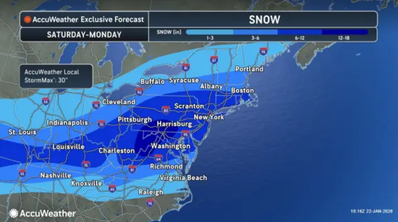
The most dangerous storm of the winter is poised to roll into the Greater Rochester area on Sunday with subzero temps and up to 10 inches of snow.
The threat of ice is also imminent with the possibility of power outages. It takes less than a half an inch of ice to bring down tree branches and down power lines.
A push of Arctic air from the north -- in many cases, the coldest air of the winter so far -- will determine the northern edge of the snow, the southern extent of the ice and where a mix of snow and ice occurs. In some areas, the prolonged nature of the storm could result in snow, ice, or a combination of both lasting well beyond 24 hours.
Today local weather maps show an expected local snowfall of three-to-six inches from Sunday afternoon through Monday afternoon, but a strong chance of up to 10 inches also exists depending on how the storm tracks.
Meanwhile, a frigid cold will usher in the weekend storm with a high on Saturday of 7 and wind chill of -13. Wind gusts will be as high as 30 mph out of the west northwest.
Sunday, when the snow is expected to start around 1 p.m. will see a high of 12 and an overnight low of 7.
The snow continues into Monday afternoon before moving out to sea.
The bitter cold continues the rest of the week with highs barely reaching 20.
Today, however, will be a good day for area residents to bring some wood in or gas up generators with highs relatively comfortable in the 40s.